01
Analyze Historical Data
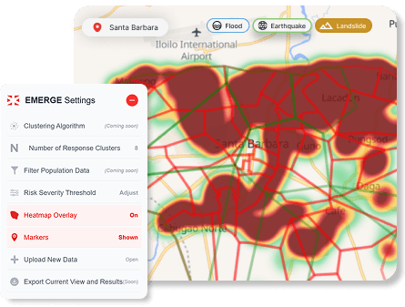
Maps hazard-prone zones using verified local historical datasets.
Visualize hazards, assign responders, and plan smarter with EMERGE's data-driven disaster management system.
Powered by proprietary algorithms, EMERGE enhances emergency response and team allocation through a decision support system using verified, location-specific data.
Core features combining hazard mapping, data clustering, and resource optimization
Integrates hazard data, population density, and terrain to surface vulnerability intersections before disasters occur.
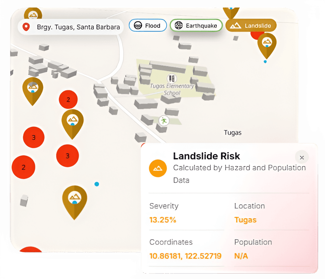
Granular analysis enables tailored response planning and allocation aligned with distinct community risk profiles.
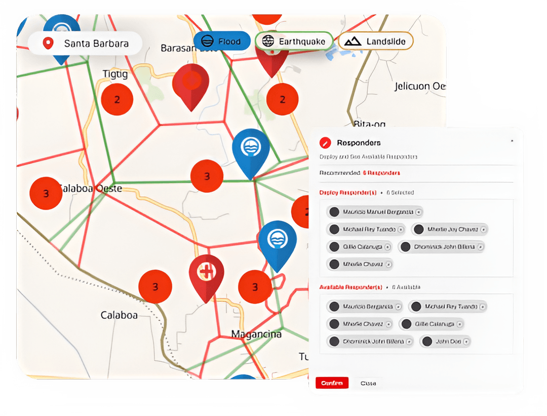
Smart clustering assesses intensity & proximity, accelerating optimal responder deployment to critical points.

Algorithmic guidance places teams and supplies where they reduce response time and maximize coverage.
Maps hazard-prone zones using verified local historical datasets.
Interactive GIS layers highlight intensity, spread, and vulnerability.
Clustering algorithms guide efficient responder & supply positioning.
Generates pre-deployment options for high-risk sectors before impact.

